Locations
Home / Locations
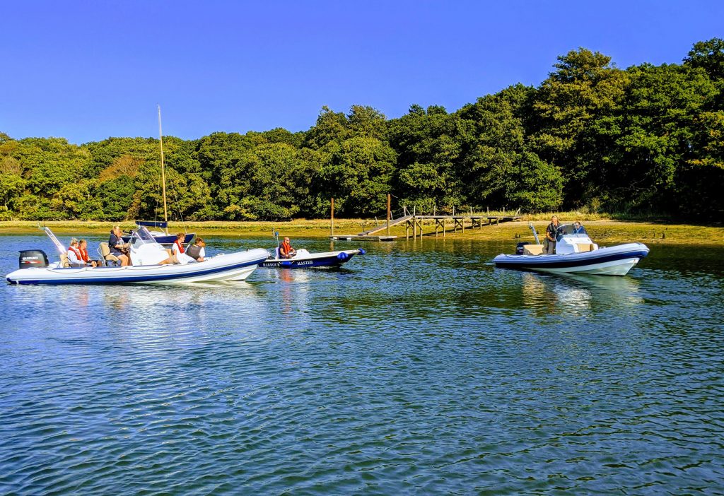
Isle of Wight RIB hire
We have a base in Bembridge harbour, but it is not often used due to the tide restrictions. We prefer to use our deep water moorings as Seaview and Seagrove Bay which are serviced by a sea taxi to get you in and out.
We also have two spaces in Cowes.
Mainland hire
We are happy to handover a RIB in Portsmouth harbour entrance area – generally our staff will meet the skipper at a chosen mooring spot and we can do the handover while the skipper drops our staff member back to Seaview,(which is around 15 minutes away). The same in reverse when returning the RIB.
We can hand over in Hamble and the renter can drop our staff member back to Cowes
.
In both cases fuel charge will start as our staff member leaves and returns to the Island bases.
We will try to accommodate delivery to other mainland Harbours, but it must be cost effective. Fuel and staff costs to get a RIB to Lymington or Chichester for instance of a single day’s hire would not be cost effective.
The boats can be moored in other harbours around the Solent, but must be kept on professionally supplied /serviced moorings or pontoon suppliers. The boats can not be left unattended while at anchor.
More details and the terms and conditions will be supplied when you make a booking.
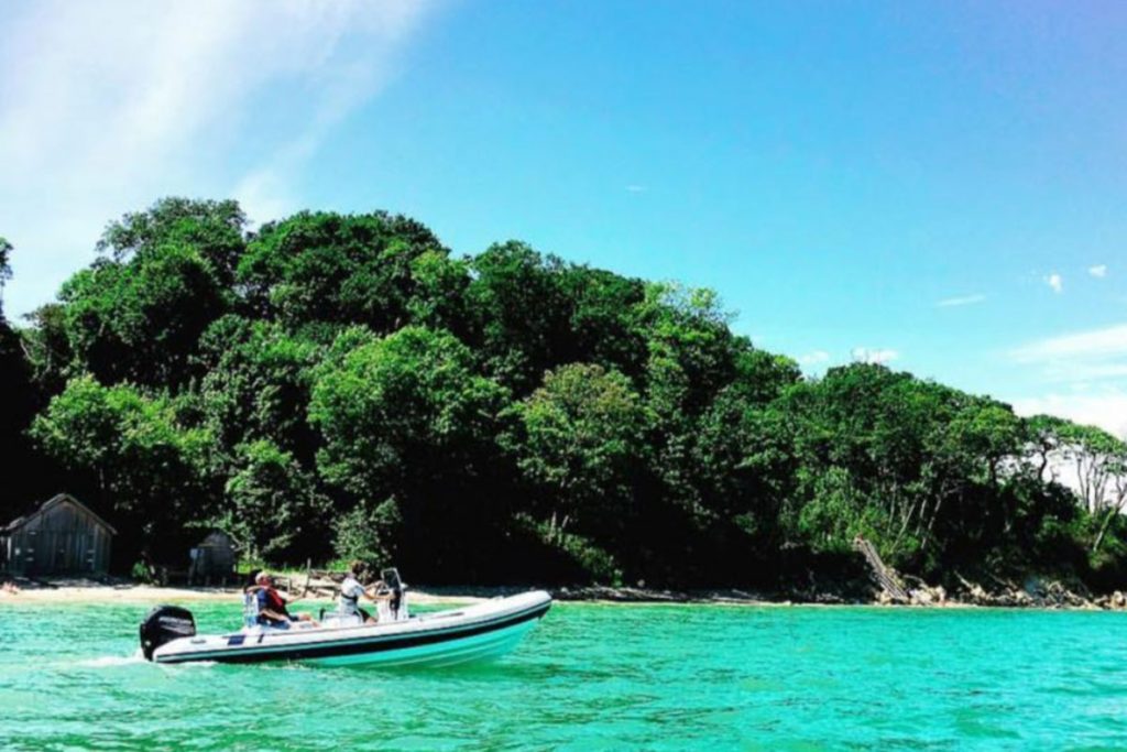
Where to visit by RIB
East to West, Isle Of Wight side:
Bembridge Lifeboat Station is the easternmost limit of the cruising area. It is a nice looking landmark – the slip end can be approached for viewing, but it is sat on a rocky ledge and strong cross currents run on rising and falling tides. It is not advised to head inwards towards the beach.
Bembridge Harbour is very tidal. For safe passage you should plan 2.5 hours either side of high water and follow the GPS and/or channel markers closely as you enter the harbour – keep to the port side.
Just outside the harbour is Baywatch on the Beach, a restaurant/cafe. On calm days it is possible to anchor just off the beach and swim in, but the boat needs to be in view at all times. Baywatch has a Facebook page (public toilets next door).
Entering Bembridge Harbour on the port side (left!) is Bembridge Point Beach and the Harbour View Cafe, which has a Facebook page (no toilets). They have a good selection of food for all tastes. You can anchor on the shallow angled Point Beach, just inside the entrance, with sand dunes behind. You need to keep an eye out as the tide goes very fast and boats regularly get stuck.
On the opposite side of the road is the Pilot Boat Inn. It has a small brewery and a selection of simple food and ice creams. Next to the Pilot Boat are some public toilets.
Just along the Embankment Road is Spinnaker Chandlery which has a huge amount of chandlery supplies, clothing, fishing/crabbing equipment, buckets and spades and surfboards.
Bembridge Harbour offers short-stay visitor moorings. Follow the channel which runs to starboard (right!) as you enter the harbour. At peak season staff will meet you and in the early season you will need to radio in – VHF channel 80. The visitor moorings lead to a landing area and at peak season it has a fun eating and drinking area,
The Duver Cafe and Steve’s Bar run from a couple of containers and have a small shop for drinks etc. Toilets are available. The harbour website is very informative and they often put on fun events.
The landing area backs onto the St Helens Duver is a National Trust site. If you need to stretch your legs you can also walk the 400m across to the Baywatch on the Beach without swimming.
On the south side of the harbour opposite the harbour office is Best Dressed Crab (same owner as Harbour View). This is a light blue single story floating building, moored on Fisherman’s pontoon. It is a well known seafood restaurant, often used by Lord Sugar (who flies into Bembridge airport) and a favourite of James Martin. You can moor beside it for a couple of hours, but it is tidal and booking is recommended.
Our base, Bembridge Marine Limited, is just to the left if you need anything. You are welcome to use our pontoon FOC. If you let us know you are stopping, we may give the boat a clean and check while you are eating.
At the west end of the harbour is Brading Haven Yacht Club, who have their own pontoon, a welcoming bunch who allow visitors. They have a bar and restaurant but are happy to supply a bowl of chips.
Our recommendation: If you want to visit the east corner – Harbour View, Pilot Boat, Spinnaker Chandlery stress free, take visitors a mooring from Bembridge Harbour. The harbour sea taxi runs a circuit to the point beach and back around the harbour. It takes the worry of tides away; you wont need to keep the boat in-sight while on anchor. If you want to be more adventurous you can take the unnamed, unmade road to the left of the Pilot Boat (next to the big white building) and walk along leafy paths to Bembridge Lifeboat Station for a look round or to have a coffee – 20 minutes each way (depending on your walking speed). Walk up the main road/hill beside the Pilot Boat to Bembridge village, 5 minutes each way. Bembridge village is a small historic village. The shops: Co-op, Boots, and range of boutique shops; Cafes – Framptons, Bembridge Bakery, fish and chips. There is also a farm shop, a fish monger, Woodfords butchers – with award winning pies and sausage rolls – recommended by James Martin (they are blooming good). There are a number of inns and pubs to eat or drink such as The Old Village Inn plus lots more interesting shops.
If you use deep water visitors mooring you will be able to get 3 hours either side of high water – as long as you follow the channel. As a local rule of thumb, if you see the sand bank on the east side of the harbour; just off point beach in front of the green boat huts with white doors, breaking above the water, you need to get a move on! Bembridge has no fuel facility, Bembridge Marine does carry a little fuel if you are desperate.
Coming out of the harbour is Bembridge Fort. It has rocks around it to break up rough seas and lobster pot ropes so don’t go too close.
The first bay west along the coast is Priory Bay. It has a small rock outcrop at either end and is tidal, so again I work on 2.5 hours either side of Portsmouth high tide. A very popular, busy bay, great for swimming and a sandy beach. The bay has an outer sandbar. It is possible to get stuck in the shallow lagoon, trapped inside the bar. The local prevailing winds are south west (island to mainland), so even in a reasonable SW wind the island’s Solent coasts are sheltered, as the winds blow overhead. Avoid Priory in an on-shore north to east wind – it has big swells which are not suitable for anchoring or landing.
Next along is Seagrove Bay, a small, exclusive, tidal bay, very pretty, nice for swimming, dry at low tide, ideal for paddling and beach games and the sea is up to the wall at high tide. Bembridge Marine has two moorings, middle of the bay, some of the furthest from the beach. These are deep water moorings, if empty, they can be used for a short stop. The same advice applies as Priory Bay.
Running west from Seagrove Bay is the village of Seaview. You need to keep at least 200m off shore as a minimum. There is a rocky ledge (good for snorkling) at the end of the Seagrove seawall, running into the Seaview front. The ledge is exposed at low tide and covered at high tide.
Seaview is a small waterfront village, with a very pro-active Yacht Club, between May to September, deep water moorings are put down and the Yacht Club runs a sea taxi service into Seaview Yacht Club slipway. Bembridge Marine has five moorings at Seaview, situated in line with the slipway (just inside the line of Seaview one design moorings). Red and grey mooring buoys with our name on it – if they are empty in the day they can be used or Seaview have visitors mooring. Seaview Yacht Club use channel P4 (where zero should be) on the VHF, and call sign “Seaview slip” The club welcomes visitors peak season they have livley inside and outside bars and lots of eating options.
Alternatively the Old Fort is a fun pub/cafe/restaurant on the front. The Seaview Hotel is also close by.
Off shore is the No Man’s Land Fort. It sits on the west end of Ryde sands, shallow 5M on the land side very deep on the Solent side. It is good area for catching Mackerel. You need head out to No Man’s if you want to avoid Ryde sands.
Moving west is Ryde sands which needs to be navigated with caution – unless you want to make the local news! and lose your deposit (see out safety notes). The beaches between Seaview and Ryde should be avoided as there are beach swimming areas and the sand bank is shallow for miles. Ryde Harbour is little used at present, it has a very short water window, a stated maximum of two hours either side of high tide. Sand has filled the harbour and I understand it is due to be dredged. It has a marked channel into the entrance, and a harbourmaster on station at peak times.
You have to go round Ryde Pier, the beaches running from Ryde to Fishbourne are not great for beach stops, there are some large random rocks near the shore line, we advise keeping off shore. If you choose to explore an area approach slowly and come into the beach at 90% with a lookout at the front.
Fishbourne is where the main Wightlink ferry comes in, you need to keep a good lookout while entering. It is also tidal – work on two and a half hours either side of high water. Fishbourne turns into Wooton Creek – the river runs down to Wooton Bridge – follow the marked channel and keep to the centre of the creek if the markers are not visible. There is lots to look at as you go down the river. The Sloop Inn is at the very end of the creek and they have a wall you can moor against to visit the pub. You need to use fenders and long, loose ropes as the boat will rise and fall against the wall with the tide.
Leaving Fishbourne to the west, towards Cowes you will see a fleet of racing dinghys and a starter box belonging to Royal Victoria Yacht Club. Close by is a red post indicating Wooton Rocks, which should be avoided (see the safety notes). You need to follow the main ferry channel out, and run down the coast, offshore.
The beaches between Fishbourne and Osbourne Bay are not great for beach stops, if you do decide to explore, keep off shore, slow and come in at 90% with a lookout. Osbourne Bay is popular for anchoring and swimming, but the beach is private (belonging to Osbourne House) and you are not permitted to land.
Heading west to Cowes you need to keep a good distance off shore around the Norris Castle headland as there are rocky outcrops. Heading into Cowes there are two entrances, the West entrance and the main entrance past the Royal Yacht Squadron.There is a public landing next to the Red Jet pontoon. This is OK for a quick drop, but you will be charged for a stop, if the harbour master is not present, they will drop a card into the boat which needs to be paid later. Bembridge Marine has two pre-paid spaces in Cowes Yacht Haven for your use, contact us for details.
Cowes Yacht Haven has a lively marina bar, restaurant and toilets. The marina has a walk through access to Cowes High Street, with lots of shops and pubs – too many to mention. Just down river is Lallows Fuel Berth and further on, just past the chain ferry is the Cowes Fuel Barge which is generally cheaper than Lallows, but often busy.
Traveling down the river there are industrial units, UKSA and on the opposite east bank East Cowes Marina. They offer short stay options and the Lifeboat Pub is on the waterside. Moving down the river, towards Newport, you will pass the old power station chimneys, at which point in the distance, you will see a building with INN on the roof in white paint. This is the Folly Inn, recently refurbished, a well known pub and restaurant. The river is all tides to this point. They offer short stay berthing, at quiet times on a pontoon, at busy times on a shared mooring in the river, with a sea taxi included in the landing fee (around £13 for a short stay). If you keep going down the river you come to Island Harbour. They have a landing pontoon and a small cafe. Island Harbour is currently in receivership so call ahead. This is the last point that has water all the time, beyond this should be taken as tidal, two and a half hours either side of high water. You can go as far as Newport Quay. The Bargemans Rest is on the quay, under the dual carriage way. Fenders and long ropes are needed, as the boat will rise and fall with the tide. Remember, it will take around an hour to get back to Cowes harbour entrance from Newport, when calculating the tide times.
Leaving Cowes to the west, the tides are strong and the bottom is gravelly, anchors don’t hold well and it isn’t easy to get ashore. The next safe stop is Newtown River/Creek is a tidal muddy creek, good to explore at high tide. Often you will see seals resting on the banks, good for an onboard lunch, but no public facilities. The coast from Newtown to Yarmouth isn’t suitable for stopping on the shore. Head out into the Solent and the next stop is Yarmouth Harbour.
Yarmouth is a busy well organised harbour, with short stay pontoons, you are normally met by a harbour master in a small boat who will direct you to the correct area. The Harbour office has toilets. Yarmouth is a historic village with lots of shops and pubs.
Leaving Yarmouth the next notable stop is Colwell Bay, a popular bay with a restaurant called The Hut . The hut has moorings off the beach and a sea taxi will bring you in and out – booking is required. In windy weather the Hut transfer dinghys dont run, they tend to have a mini bus running from Yarmouth. If you leave Colwell Bay heading to the Needles you need to go offshore as there is an out crop of rocks at the end of Colwell Bay (see the safety info). You can go as far as the Needles, but no further out as our permitted limit is a line from Hurst Castle to the Needles on the island side.
The wreck of Vavassi is 100m off the end of the Needles, just below the surface. It will be on the GPS.
West to East, Mainland side:
Just to the west of Hurst Castle is an entrance which leads through the salt marshes to Keyhaven. It is tidal and has water for approximately two and a half hours either side of high water at Hurst Castle. Keyhaven Yacht Club welcomes visiting yachtsmen.There is a ferry which can take you to Hurst castle. The Gun Inn is in Keyhaven so is not far from the quay.
Lymington is a busy harbour and has full time water access to the town. There are short stay pontoons with landing fees, the town is a short walk away with shops, pubs and restaurants.
The coast from Lymington to Beaulieu River is exposed and not suitable for stopping. The Beaulieu River is great to visit. It is not tide dependant; enter the river entrance and enjoy the long run up the river through marshes and tree-lined rivers to Bucklers Hard which will take around 30 minutes @ 6kn. Bucklers Hard offers short stay moorings, peak season you will be met by a harbourmaster and directed to a space. The Master Builder pub is situated on a grass hill that runs to the water and the hotel has a good selection of food, including a summer BBQ. Great for kids to run around, alternatively take a picnic and a rug.
Southampton Water is a huge port with a few places you may like to visit. Ashlett Creek is a tiny inlet on the Port / east side of Southampton water, just past Calshot, but before you reach the tanker terminal. The inlet is marked with wooden sticks either side and leads to a small opening. There is a sailing club and one pub, The Jolly Sailor. Access is very limited, work on two hours either side of high tide in Southampton.
The Hamble River on the starboard side, West bank, has Hamble Point Marina. They offer a short stay with a landing fee, there is a cafe in the marina.
At the end of the river opposite Swanick marina is the Jolly Sailor, a historic waterside pub with cobblestone floors. It has a pontoon which is accessible to most states of the tide, I understand it dries out for three hours over low tide.
Hythe marina offers short stays with a landing fee, the marina is modern and has a London style cafe and bar.
The coast from Southampton to Portsmouth is exposed and gravel anchoring, we don’t recommend you stop here.
Portsmouth, east side of the harbour : is a busy commercial and Navy port. As you enter, one third of the channel on the Port / East side, is designated for small boats, the starboard two thirds for large vessels. Just inside the entrance is Gosport Marina. They have a seasonal lightship restaurant. If you go for a drive through tour of the marina area you will see the historic submarine HMS Alliance on the waterside, with a museum. Exit the marina and head down Portsmouth Harbour, you will pass the Gosport ferry terminal, then Premmier Gosport Marina. It has a short stay option with landing fee and restaurant in the marina. It also has a self service fuel berth – it takes cards. You have to estimate how much you need before it starts. They often run out of fuel on weekends. Heading down Portsmouth Harbour on the Port / east side is a fuel terminal, Navy base and Navy marina and moorings. The channel splits, to the east, and runs a good distance down to Fareham, there is a small public landing, a pub Castle in the air. Take the west chanel and it will take you down to Portchester and Port solent. Port Solent has a fuel berth, offering short stays with a landing fee.
Portsmouth west side of the harbour. You have to enter the harbour on the East side and run down, until just before the Gosport ferry terminal. You will find a Ballast buoy – a red post, opposite the spinnaker tower. Call on the VHF channel 11 “(Kings harbour master ) KHM, KHM this is RIB hire number [and state RIB hire boat number]. Permission to cross to Camber dock or Gunwhalf “. You will get a response, advising on any large traffic movements if needs be. Entering Camber dock be very careful of Wightlink ferries. The propeller wash can be dangerous – look out for funnel smoke which may indicate it is about to move. Opposite Wightlink terminal (next to the Ben Ainsley building) is a public slipway. You can land or pick up, but it only has a rusty steel wall beside the slip to moor on. You need fenders and to stay with the boat. If you carry on around Camber dock you come to a small marina which is private (KB drystack) and on the corner The Bridge Tavern. You can moor beside the wall if there is space. You need fenders and long loose rope as there is a huge tide rise and fall, some 5m, keep a close eye on the boat. We have had damage caused to the boats in the past from this spot.
If you cross to Gunwhalf Quays they have short stay facilities with a landing fee. You can also just pick up and drop off crew with a smaller landing fee. Call on VHF chanel 80 as you enter for a mooring spot. Fenders are needed as there are barnacles on the floats. You cannot visit any other part of the west side of Portsmouth Harbour, it is a Navy base with police patrols running down to the harbour, commercial port areas and a Navy shooting range.
Leaving Portsmouth west towards Hayling Island the beaches are not sutable for stopping. You will come to the Submarine Barrage, which runs from Horse Sands Fort to the shore, It is made up of concrete blocks just below the water. (see the safety advice). You have to go through the opening, which is clearly marked. Hayling Island has one public landing pontoon Easterny Landing for picking up and dropping off, it is also used for the Hayling ferry, you should not leave the boat moored here. There is not a safe public landing on the east side either. You can run up through the west harbour channel @ 6kn to Northerny, but the opening at Northerny bridge is tidal, around 2.5 hours either side of high water. You need to carefully follow the narrow channel between the large concrete blocks as you reach the bridge. Northerney Marina is just on the far side of the bridge.
Leaving Hayling Island Harbour entrance, towards Chichester harbour, the coast has lots of sandy beaches. However, this area is full of swimmers, breakwaters and very shallow shelving and often there are big swells so we don’t recommend anchoring here.
Chichester is the western most limits of our allowed cruising area. The main channels have water at all tides, although some of the smaller side channels dry out so be careful and be sure to follow the channel accurately.
There is a shallow sand bar on the port side (east) of the Chichester channel as you first enter. You need to follow the well marked channel markers from the beginning – don’t cut the corner.
Entering the harbour on the port side (east) you have Chicester Sailing Club on the point; which operates from the beach and has no visitor pontoon spaces. Carry on to the port side and you will come to Sparks Marina who have a short stay option with landing fees. There is a cafe in the marina. If you carry on ahead as you enter the harbour; towards Thorney Island; you will eventually arrive in Northerney Marina and bridge which leads back into the Hayling Island under the bridge as described in the Hayling paragraph. If you come into the harbour and take the starboard channel, first you pass East Head with sandy beach anchoring at high tide only. Carry on up the channel and you come to Itchenor, a small waterside village with pubs and cafes. They have a public pontoon with a landing fee. The short stay pontoon is very tidal, so you need to keep an eye on the boat. Carry on past Itchenor and you will come to Chicester Marina, with lock gates. They offer a short stay pontoon with landing fees. In the marina is a restaurant. They have water for the short stay pontoon 90% of the time.
Ready to hire a RIB in the Solent
To hire a RIB in from Bembridge Marine, contact us in the first instance and talk to our experienced team